
Quintana topographic map
Interactive map
Click on the map to display elevation.
About this map
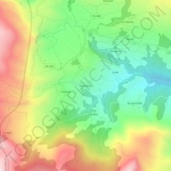
Name: Quintana topographic map, elevation, terrain.
Location: Quintana, Soba, Asón-Agüera, Cantabria, 39806, España (43.16239 -3.58876 43.20239 -3.54876)
Average elevation: 661 m
Minimum elevation: 313 m
Maximum elevation: 1,120 m