
RW 02 topographic map
Interactive map
Click on the map to display elevation.
About this map
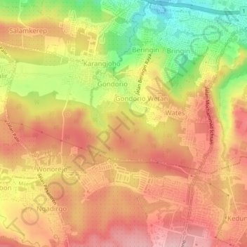
Name: RW 02 topographic map, elevation, terrain.
Location: RW 02, Wates, Ngaliyan, Semarang, Central Java, Indonesia (-7.03389 110.30394 -6.99389 110.34394)
Average elevation: 156 m
Minimum elevation: 52 m
Maximum elevation: 223 m