
Gelderhorsten topographic map
Interactive map
Click on the map to display elevation.
About this map
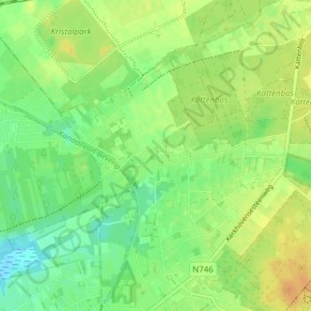
Name: Gelderhorsten topographic map, elevation, terrain.
Average elevation: 45 m
Minimum elevation: 31 m
Maximum elevation: 59 m
Other topographic maps
Click on a map to view its topography, its elevation and its terrain.
Blauwe Kei
België > Limburg > Maaseik > Lommel
Blauwe Kei, Lommel, Maaseik, Limburg, Vlaanderen, 3920, België
Average elevation: 39 m