
Claret topographic map
Interactive map
Click on the map to display elevation.
About this map
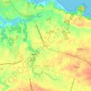
Name: Claret topographic map, elevation, terrain.
Location: Claret, Le Moule, Pointe-à-Pitre, Guadeloupe, 97160, France (16.28989 -61.33520 16.32989 -61.29520)
Average elevation: 27 m
Minimum elevation: -1 m
Maximum elevation: 46 m