
Saint Vincent Island topographic map
Interactive map
Click on the map to display elevation.
About this map
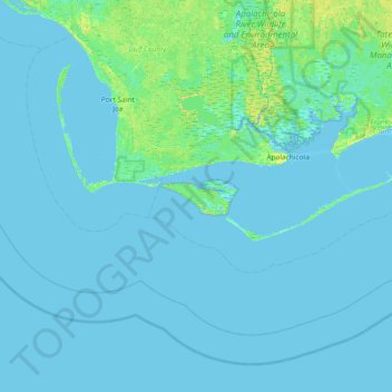
Name: Saint Vincent Island topographic map, elevation, terrain.
Average elevation: 2 m
Minimum elevation: -5 m
Maximum elevation: 16 m
Other topographic maps
Click on a map to view its topography, its elevation and its terrain.
Lanark Village
United States > Florida > Franklin County
Lanark Village, Franklin County, Florida, 32323, United States
Average elevation: 5 m
Carabelle Beach
United States > Florida > Franklin County > Carrabelle
Carabelle Beach, Carrabelle, Franklin County, Florida, United States
Average elevation: 3 m
Carrabelle
United States > Florida > Franklin County
Carrabelle, Franklin County, Florida, United States
Average elevation: 3 m
Saint Teresa
United States > Florida > Franklin County
Saint Teresa, Franklin County, Florida, United States
Average elevation: 4 m