
Rio Maior topographic map
Interactive map
Click on the map to display elevation.
About this map
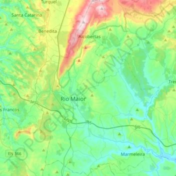
Name: Rio Maior topographic map, elevation, terrain.
Location: Rio Maior, Santarém, Portugal (39.23491 -9.00157 39.46601 -8.78307)
Average elevation: 129 m
Minimum elevation: 5 m
Maximum elevation: 494 m
Other topographic maps
Click on a map to view its topography, its elevation and its terrain.
Serra de Santo António
Portugal > Santarém > Alcanena
Serra de Santo António, Alcanena, Santarém, Portugal
Average elevation: 338 m