
Findon topographic map
Interactive map
Click on the map to display elevation.
About this map
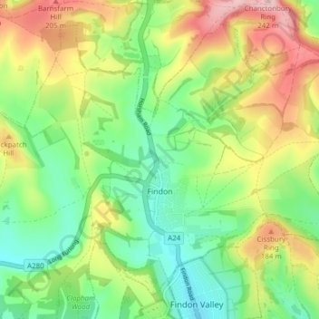
Name: Findon topographic map, elevation, terrain.
Location: Findon, Arun, West Sussex, England, United Kingdom (50.85227 -0.44001 50.89338 -0.36352)
Average elevation: 114 m
Minimum elevation: 32 m
Maximum elevation: 238 m
Other topographic maps
Click on a map to view its topography, its elevation and its terrain.
Littlehampton
United Kingdom > England > West Sussex > Arun
Littlehampton, Arun, West Sussex, England, United Kingdom
Average elevation: 3 m
Arundel
United Kingdom > England > West Sussex > Arun > Arundel
Arundel, Arun, West Sussex, England, United Kingdom
Average elevation: 28 m