
Tegal topographic map
Interactive map
Click on the map to display elevation.
About this map
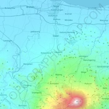
Name: Tegal topographic map, elevation, terrain.
Location: Tegal, Central Java, Indonesia (-7.26839 108.95146 -6.84429 109.36037)
Average elevation: 335 m
Minimum elevation: -2 m
Maximum elevation: 3,408 m
Other topographic maps
Click on a map to view its topography, its elevation and its terrain.
Tegal
Indonesia > Central Java > Tegal
Tegal, Central Java, Java, 52131, Indonesia
Average elevation: 15 m