
鞍山市 topographic map
Interactive map
Click on the map to display elevation.
About this map
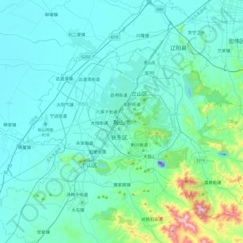
Name: 鞍山市 topographic map, elevation, terrain.
Location: 鞍山市, 铁东区, 鞍山市, Liaoning, China (40.94812 122.82997 41.26812 123.14997)
Average elevation: 78 m
Minimum elevation: -60 m
Maximum elevation: 670 m