
Azilal topographic map
Interactive map
Click on the map to display elevation.
About this map
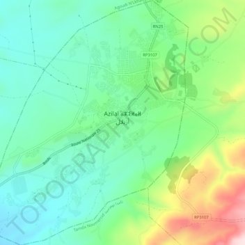
Name: Azilal topographic map, elevation, terrain.
Average elevation: 1,369 m
Minimum elevation: 1,257 m
Maximum elevation: 1,628 m
Azilale se trouve dans le Haut Atlas, à 1 351 m d'altitude. Ses coordonnées géographiques sont. 31° 57′ 51″ N, 6° 34′ 27″ O.