
Jambes topographic map
Interactive map
Click on the map to display elevation.
About this map
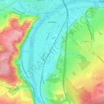
Name: Jambes topographic map, elevation, terrain.
Location: Jambes, Namen, Wallonië, 5100, België (50.43063 4.86143 50.46646 4.90793)
Average elevation: 126 m
Minimum elevation: 71 m
Maximum elevation: 217 m
Other topographic maps
Click on a map to view its topography, its elevation and its terrain.