
Thank you for supporting this site ❤️
Make a donation
Make a donation
Llechryd topographic map
Click on the map to display elevation.
Thank you for supporting this site ❤️
Make a donation
Make a donation
About this map
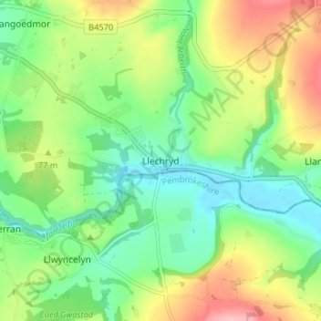
Name: Llechryd topographic map, elevation, terrain.
Location: Llechryd, Ceredigion, Wales, SA43 2NX, United Kingdom (52.04386 -4.62082 52.08386 -4.58082)
Average elevation: 60 m
Minimum elevation: 4 m
Maximum elevation: 156 m
Thank you for supporting this site ❤️
Make a donation
Make a donation