
Thank you for supporting this site ❤️
Make a donation
Make a donation
Anse Kerlan topographic map
Click on the map to display elevation.
Thank you for supporting this site ❤️
Make a donation
Make a donation
About this map
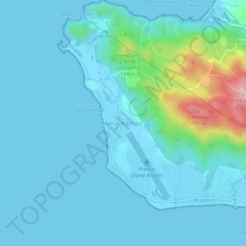
Name: Anse Kerlan topographic map, elevation, terrain.
Location: Anse Kerlan, Grand'Anse Praslin District, Praslin, Seychelles (-4.33232 55.66744 -4.29232 55.70744)
Average elevation: 42 m
Minimum elevation: -2 m
Maximum elevation: 327 m
Thank you for supporting this site ❤️
Make a donation
Make a donation