
Thank you for supporting this site ❤️
Make a donation
Make a donation
Hastings topographic map
Click on the map to display elevation.
Thank you for supporting this site ❤️
Make a donation
Make a donation
About this map
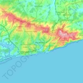
Name: Hastings topographic map, elevation, terrain.
Location: Hastings, East Sussex, England, United Kingdom (50.84108 0.50061 50.89483 0.65896)
Average elevation: 36 m
Minimum elevation: -1 m
Maximum elevation: 173 m
Thank you for supporting this site ❤️
Make a donation
Make a donation