
Thank you for supporting this site ❤️
Make a donation
Make a donation
Poundon topographic map
Click on the map to display elevation.
Thank you for supporting this site ❤️
Make a donation
Make a donation
About this map
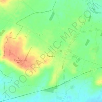
Name: Poundon topographic map, elevation, terrain.
Location: Poundon, Buckinghamshire, England, United Kingdom (51.91272 -1.08671 51.93563 -1.04858)
Average elevation: 93 m
Minimum elevation: 73 m
Maximum elevation: 118 m
Thank you for supporting this site ❤️
Make a donation
Make a donation
Other topographic maps
Click on a map to view its topography, its elevation and its terrain.
Thank you for supporting this site ❤️
Make a donation
Make a donation
Thank you for supporting this site ❤️
Make a donation
Make a donation