
Alvor topographic map
Interactive map
Click on the map to display elevation.
About this map
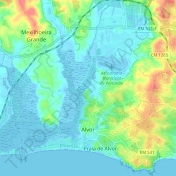
Name: Alvor topographic map, elevation, terrain.
Location: Alvor, Portimão, Faro, Portugal (37.11415 -8.62157 37.17064 -8.56067)
Average elevation: 15 m
Minimum elevation: -3 m
Maximum elevation: 62 m
Other topographic maps
Click on a map to view its topography, its elevation and its terrain.