
Oumesnat topographic map
Interactive map
Click on the map to display elevation.
About this map
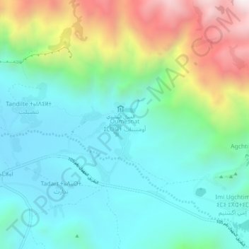
Name: Oumesnat topographic map, elevation, terrain.
Average elevation: 1,260 m
Minimum elevation: 938 m
Maximum elevation: 2,095 m
Other topographic maps
Click on a map to view its topography, its elevation and its terrain.
Gdourt
Maroc > cercle de Tafraout > Afella Ighir
Gdourt, Afella Ighir, caïdat d'Afella Ighir, cercle de Tafraout, Province de Tiznit, Souss-Massa, Maroc
Average elevation: 1,310 m