
Thank you for supporting this site ❤️
Make a donation
Make a donation
Tungkillo topographic map
Click on the map to display elevation.
Thank you for supporting this site ❤️
Make a donation
Make a donation
Tungkillo
Tungkillo (34°49′S 139°04′E / 34.817°S 139.067°E / -34.817; 139.067, postcode 5236, altitude 391m) is a town in South Australia, located approximately 5 km (3.1 mi) south of Mount Pleasant. It sits on Adelaide-Mannum Road, 60 km (37 mi) north-east of the state capital, Adelaide and 25 km (16 mi) north-west of Mannum. At the 2006 census, Tungkillo had a population of 360.
Thank you for supporting this site ❤️
Make a donation
Make a donation
About this map
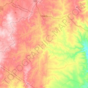
Name: Tungkillo topographic map, elevation, terrain.
Average elevation: 373 m
Minimum elevation: 116 m
Maximum elevation: 541 m
Thank you for supporting this site ❤️
Make a donation
Make a donation
Other topographic maps
Click on a map to view its topography, its elevation and its terrain.