
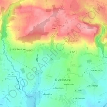
La Bazoge topographic map
Interactive map
Click on the map to display elevation.
About this map
Name: La Bazoge topographic map, elevation, terrain.
Average elevation: 147 m
Minimum elevation: 93 m
Maximum elevation: 212 m
Other topographic maps
Click on a map to view its topography, its elevation and its terrain.
Chasseguey
France > Normandie > Manche > Juvigny les Vallées
Chasseguey, Juvigny les Vallées, Avranches, Manche, Normandie, France métropolitaine, 50520, France
Average elevation: 144 m
Gîte d'Etape
France > Normandie > Manche > Juvigny les Vallées
Gîte d'Etape, Route du Moulin, Bellefontaine, Juvigny les Vallées, Avranches, Manche, Normandie, France métropolitaine, 50520, France
Average elevation: 231 m
Chérencé-le-Roussel
France > Normandie > Manche > Juvigny les Vallées
Chérencé-le-Roussel, Juvigny les Vallées, Avranches, Manche, Normandie, France métropolitaine, 50520, France
Average elevation: 185 m