
Mohiville topographic map
Interactive map
Click on the map to display elevation.
About this map
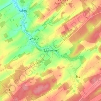
Name: Mohiville topographic map, elevation, terrain.
Location: Mohiville, Hamois, Dinant, Namen, Wallonië, 5361, België (50.29767 5.17233 50.33767 5.21233)
Average elevation: 301 m
Minimum elevation: 251 m
Maximum elevation: 337 m