
Castainço topographic map
Interactive map
Click on the map to display elevation.
About this map
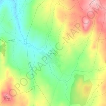
Name: Castainço topographic map, elevation, terrain.
Location: Castainço, Penedono, Viseu, Portugal (40.97534 -7.46804 41.01534 -7.42804)
Average elevation: 825 m
Minimum elevation: 707 m
Maximum elevation: 974 m
Other topographic maps
Click on a map to view its topography, its elevation and its terrain.
Penedono e Granja
Penedono e Granja, Penedono, Viseu, Portugal
Average elevation: 855 m
Penela da Beira
Penela da Beira, Penedono, Viseu, Portugal
Average elevation: 828 m