
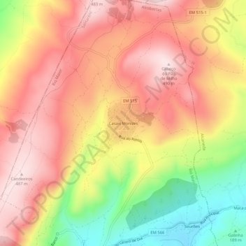
Casais Monizes topographic map
Interactive map
Click on the map to display elevation.
About this map
Name: Casais Monizes topographic map, elevation, terrain.
Average elevation: 336 m
Minimum elevation: 113 m
Maximum elevation: 488 m
Other topographic maps
Click on a map to view its topography, its elevation and its terrain.
Candeeiros
Portugal > Santarém > Alcobertas
Candeeiros, Alcobertas, Rio Maior, Santarém, 2040-018, Portugal
Average elevation: 363 m