Geolocate

Canary Islands topographic map

Click on the map to display elevation.

About this map

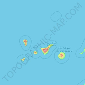
Name: Canary Islands topographic map, elevation, terrain.

Location: Canary Islands, Spain (27.43354 -18.39368 29.91180 -13.10126)

Average elevation: 13 m

Minimum elevation: 0 m

Maximum elevation: 3,432 m

The Canary Islands, especially Tenerife, Gran Canaria, Fuerteventura, and Lanzarote, are a major tourist destination, with over 12 million visitors per year. This is due to their beaches, subtropical climate, and important natural attractions, especially Maspalomas in Gran Canaria and Mount Teide (a World Heritage Site) in Tenerife. Mount Teide is the highest peak in Spain and the 4th tallest volcano in the world, measured from its base on the ocean floor. The islands have warm summers and winters warm enough for the climate to be technically tropical at sea level. The amount of precipitation and the level of maritime moderation vary depending on location and elevation. The archipelago includes green areas as well as desert. The islands' high mountains are ideal for astronomical observation, because they lie above the temperature inversion layer. As a result, the archipelago boasts two professional observatories: the Teide Observatory on Tenerife, and Roque de los Muchachos Observatory on La Palma.

Wikipedia (CC-BY-SA 3.0)

Other topographic maps

Click on a map to view its topography, its elevation and its terrain.

la Pobla de Farnals

Spain > Valencian Community

la Pobla de Farnals, l'Horta Nord, Valencia, Valencian Community, Spain

Average elevation: 15 m

Bailén

Spain > Andalusia

Bailén, Jaén, Andalusia, 23710, Spain

Average elevation: 329 m

Ceuta

Spain

Ceuta, 51001, Spain

Average elevation: 45 m

León

Spain > Castile and León

León, Castile and León, Spain

Average elevation: 913 m

Ceuta

Spain

Ceuta, Spain

Average elevation: 76 m

Real Sitio de San Ildefonso

Spain > Castile and León

Real Sitio de San Ildefonso, Segovia, Castile and León, Spain

Average elevation: 1,562 m

San Cristóbal de La Laguna

Spain

San Cristóbal de La Laguna, Santa Cruz de Tenerife, Canary Islands, Spain

Average elevation: 408 m

La Palma

Spain > Murcia > Cartagena

La Palma, Diputación de La Palma, Cartagena, Campo de Cartagena, Murcia, Spain

Average elevation: 34 m

SS-2

Spain > Cantabria > Rionansa

SS-2, San Sebastián de Garabandal, Rionansa, Saja-Nansa, Cantabria, 39554, Spain

Average elevation: 917 m

Balearic Islands

Spain

Balearic Islands, Spain

Average elevation: 9 m

Buenavista

Spain > Castile and León

Buenavista, Tierra de Alba, Salamanca, Castile and León, 37789, Spain

Average elevation: 924 m

Firgas

Spain > Canary Islands

Firgas, Las Palmas, Canary Islands, Spain

Average elevation: 411 m

Asturias

Spain

Asturias, Spain

Average elevation: 569 m

Melilla

Spain

Melilla, Spain

Average elevation: 31 m

El Chivero

Spain > Castile and León > Boñar

El Chivero, Boñar, León, Castile and León, 24850, Spain

Average elevation: 1,107 m

Jerez

Spain > Andalusia

Jerez, Cádiz, Andalusia, Spain

Average elevation: 44 m