
Thank you for supporting this site ❤️
Make a donation
Make a donation
Kenilworth topographic map
Click on the map to display elevation.
Thank you for supporting this site ❤️
Make a donation
Make a donation
About this map
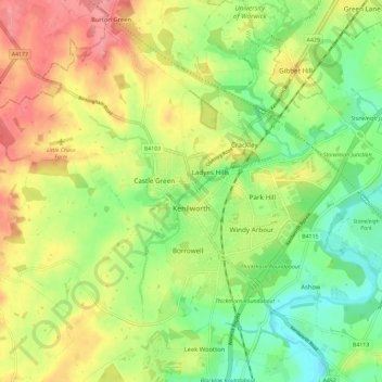
Name: Kenilworth topographic map, elevation, terrain.
Location: Kenilworth, Warwick, Warwickshire, England, United Kingdom (52.32296 -1.64648 52.37350 -1.53126)
Average elevation: 88 m
Minimum elevation: 48 m
Maximum elevation: 136 m
Thank you for supporting this site ❤️
Make a donation
Make a donation
Other topographic maps
Click on a map to view its topography, its elevation and its terrain.