
La Cure topographic map
Interactive map
Click on the map to display elevation.
About this map
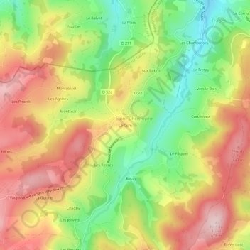
Name: La Cure topographic map, elevation, terrain.
Average elevation: 515 m
Minimum elevation: 359 m
Maximum elevation: 665 m
Other topographic maps
Click on a map to view its topography, its elevation and its terrain.
Les Jolivets
France > Auvergne-Rhône-Alpes > Rhône > Deux-Grosnes > Saint-Christophe
Les Jolivets, Saint-Christophe, Deux-Grosnes, Villefranche-sur-Saône, Rhône, Auvergne-Rhône-Alpes, France métropolitaine, 69860, France
Average elevation: 559 m