
Thank you for supporting this site ❤️
Make a donation
Make a donation
Penhalonga topographic map
Click on the map to display elevation.
Thank you for supporting this site ❤️
Make a donation
Make a donation
About this map
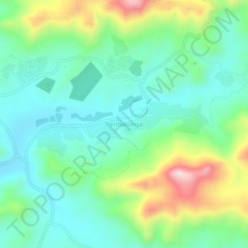
Name: Penhalonga topographic map, elevation, terrain.
Location: Penhalonga, Mutasa, Manicaland Province, Zimbabwe (-18.90188 32.65450 -18.86188 32.69450)
Average elevation: 1,239 m
Minimum elevation: 1,126 m
Maximum elevation: 1,512 m
Thank you for supporting this site ❤️
Make a donation
Make a donation
Other topographic maps
Click on a map to view its topography, its elevation and its terrain.