
Bois de Saxe topographic map
Interactive map
Click on the map to display elevation.
About this map
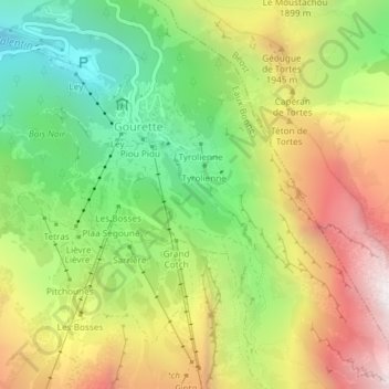
Name: Bois de Saxe topographic map, elevation, terrain.
Average elevation: 1,676 m
Minimum elevation: 1,112 m
Maximum elevation: 2,362 m
Other topographic maps
Click on a map to view its topography, its elevation and its terrain.
Pic de Ger
France > Nouvelle-Aquitaine > Eaux-Bonnes
Pic de Ger, Eaux-Bonnes, Oloron-Sainte-Marie, Pyrénées-Atlantiques, Nouvelle-Aquitaine, France métropolitaine, 64440, France
Average elevation: 2,141 m
Les Trois Dents
France > Nouvelle-Aquitaine > Eaux-Bonnes
Les Trois Dents, Eaux-Bonnes, Oloron-Sainte-Marie, Pyrénées-Atlantiques, Nouvelle-Aquitaine, France métropolitaine, 64440, France
Average elevation: 2,199 m