
José Cardel topographic map
Interactive map
Click on the map to display elevation.
About this map
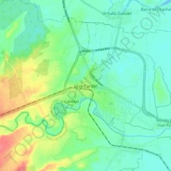
Name: José Cardel topographic map, elevation, terrain.
Location: José Cardel, La Antigua, Veracruz, 91680, México (19.33117 -96.41748 19.41117 -96.33748)
Average elevation: 21 m
Minimum elevation: 0 m
Maximum elevation: 72 m
Other topographic maps
Click on a map to view its topography, its elevation and its terrain.
Río La Antigua
México > Veracruz > La Antigua > José Cardel
Río La Antigua, José Cardel, La Antigua, Veracruz, 91680, México
Average elevation: 20 m