
Godwin topographic map
Interactive map
Click on the map to display elevation.
About this map
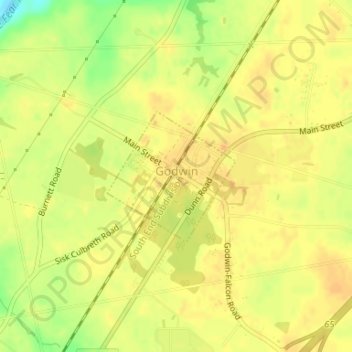
Name: Godwin topographic map, elevation, terrain.
Location: Godwin, Cumberland County, North Carolina, United States (35.21221 -78.68690 35.22221 -78.67484)
Average elevation: 45 m
Minimum elevation: 22 m
Maximum elevation: 53 m
Other topographic maps
Click on a map to view its topography, its elevation and its terrain.