
Reserva Natural das Lagoas de Santo André e da Sancha topographic map
Interactive map
Click on the map to display elevation.
About this map
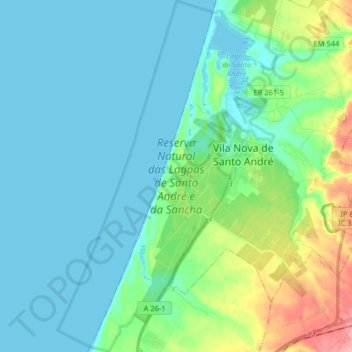
Name: Reserva Natural das Lagoas de Santo André e da Sancha topographic map, elevation, terrain.
Average elevation: 22 m
Minimum elevation: 0 m
Maximum elevation: 108 m
Other topographic maps
Click on a map to view its topography, its elevation and its terrain.