
常州市 / Changzhou topographic map
Interactive map
Click on the map to display elevation.
About this map
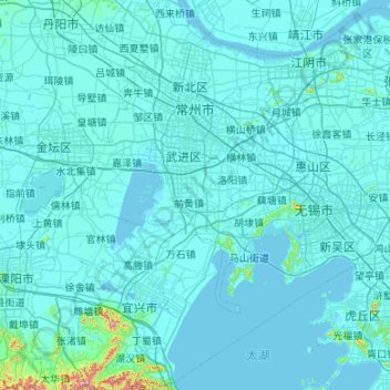
Name: 常州市 / Changzhou topographic map, elevation, terrain.
Location: 常州市 / Changzhou, Jiangsu, 213000, China (31.15441 119.13585 32.06173 120.20114)
Average elevation: 14 m
Minimum elevation: -5 m
Maximum elevation: 563 m
Other topographic maps
Click on a map to view its topography, its elevation and its terrain.