
منطقة ادلب topographic map
Interactive map
Click on the map to display elevation.
About this map
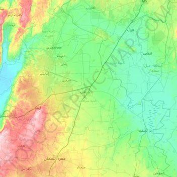
Name: منطقة ادلب topographic map, elevation, terrain.
Location: منطقة ادلب, Gouvernorat d'Idleb, Syrie (35.60473 36.42950 36.14367 37.14396)
Average elevation: 392 m
Minimum elevation: 215 m
Maximum elevation: 919 m
Other topographic maps
Click on a map to view its topography, its elevation and its terrain.
Idlib
Syrie > Gouvernorat d'Idleb > Idlib
Idlib, ناحية ادلب, منطقة ادلب, Gouvernorat d'Idleb, 0096323, Syrie
Average elevation: 395 m