
Vallée Tuauru topographic map
Interactive map
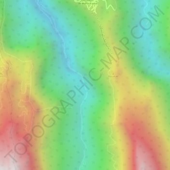
Click on the map to display elevation.
About this map
Name: Vallée Tuauru topographic map, elevation, terrain.
Average elevation: 540 m
Minimum elevation: 87 m
Maximum elevation: 1,146 m
Other topographic maps
Click on a map to view its topography, its elevation and its terrain.
Māhina
France > Polynésie française > Îles du Vent > Mahina
Māhina, Mahina, Îles du Vent, Polynésie française, 98709, France
Average elevation: 99 m