
Upper Hunter Shire Council topographic map
Interactive map
Click on the map to display elevation.
About this map
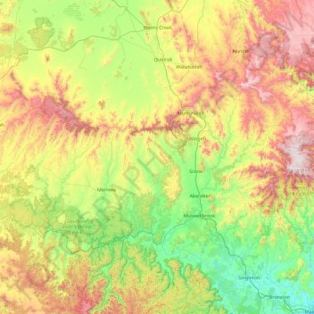
Name: Upper Hunter Shire Council topographic map, elevation, terrain.
Location: Upper Hunter Shire Council, New South Wales, Australia (-32.40880 149.79185 -31.55374 151.59389)
Average elevation: 493 m
Minimum elevation: 6 m
Maximum elevation: 1,575 m
Other topographic maps
Click on a map to view its topography, its elevation and its terrain.