
Puerto Gaitán topographic map
Interactive map
Click on the map to display elevation.
About this map
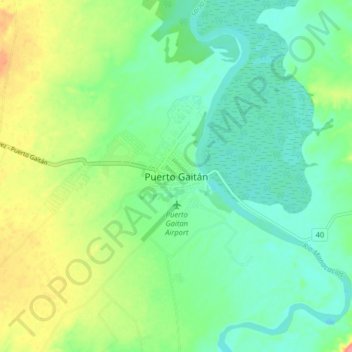
Name: Puerto Gaitán topographic map, elevation, terrain.
Location: Puerto Gaitán, Puerto Carreño, Rio Meta, Meta, 86084, Colombia (4.27207 -72.12295 4.35207 -72.04295)
Average elevation: 161 m
Minimum elevation: 137 m
Maximum elevation: 209 m
Other topographic maps
Click on a map to view its topography, its elevation and its terrain.
Caserío Indigena China
Colombia > Meta > Puerto Gaitán
Caserío Indigena China, Puerto Gaitán, Rio Meta, Meta, RAP (Especial) Central, Colombia
Average elevation: 158 m