
Tipaza topographic map
Interactive map
Click on the map to display elevation.
About this map
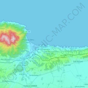
Name: Tipaza topographic map, elevation, terrain.
Location: Tipaza, Daïra Tipaza, Tipaza, 42000, Algérie (36.54833 2.30035 36.64548 2.51776)
Average elevation: 81 m
Minimum elevation: -1 m
Maximum elevation: 886 m
Other topographic maps
Click on a map to view its topography, its elevation and its terrain.