
Slateford topographic map
Interactive map
Click on the map to display elevation.
About this map
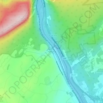
Name: Slateford topographic map, elevation, terrain.
Average elevation: 192 m
Minimum elevation: 79 m
Maximum elevation: 442 m
Other topographic maps
Click on a map to view its topography, its elevation and its terrain.
Mount Bethel
United States > Pennsylvania > Northampton County > Upper Mount Bethel Township
Mount Bethel, Upper Mount Bethel Township, Northampton County, Pennsylvania, 18351, United States
Average elevation: 156 m