
Chelyabinsk Oblast topographic map
Interactive map
Click on the map to display elevation.
About this map
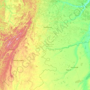
Name: Chelyabinsk Oblast topographic map, elevation, terrain.
Location: Chelyabinsk Oblast, Ural Federal District, Russia (51.99088 57.13129 56.36572 63.35201)
Average elevation: 301 m
Minimum elevation: 63 m
Maximum elevation: 1,525 m
Other topographic maps
Click on a map to view its topography, its elevation and its terrain.
Verhniy Ufaley
Russia > Chelyabinsk Oblast > Verhniy Ufaley
Verhniy Ufaley, Verkhny Ufaley, Chelyabinsk Oblast, Ural Federal District, 456800, Russia
Average elevation: 393 m