
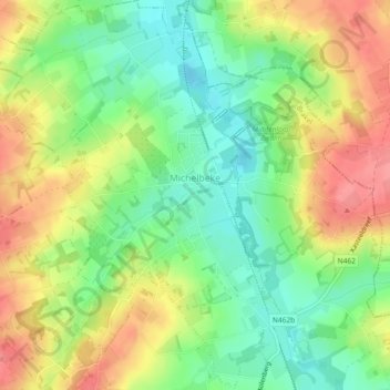
Michelbeke topographic map
Interactive map
Click on the map to display elevation.
About this map
Name: Michelbeke topographic map, elevation, terrain.
Average elevation: 57 m
Minimum elevation: 21 m
Maximum elevation: 99 m
Other topographic maps
Click on a map to view its topography, its elevation and its terrain.
Michelbeke
België > Oost-Vlaanderen > Oudenaarde > Michelbeke
Michelbeke, Brakel, Oudenaarde, Oost-Vlaanderen, Vlaanderen, België
Average elevation: 59 m