
Vasa Park topographic map
Interactive map
Click on the map to display elevation.
About this map
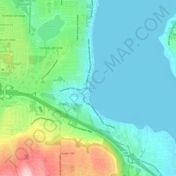
Name: Vasa Park topographic map, elevation, terrain.
Average elevation: 75 m
Minimum elevation: 3 m
Maximum elevation: 285 m
Other topographic maps
Click on a map to view its topography, its elevation and its terrain.
Cougar Hills
United States > Washington > King County > Bellevue
Cougar Hills, Bellevue, King County, Washington, 99007, United States
Average elevation: 161 m
Lake Hills
United States > Washington > King County > Bellevue
Lake Hills, Bellevue, King County, Washington, 98008, United States
Average elevation: 80 m
Somerset
United States > Washington > King County > Bellevue > Somerset
Somerset, Bellevue, King County, Washington, 98006, United States
Average elevation: 131 m