
Laneffe topographic map
Interactive map
Click on the map to display elevation.
About this map
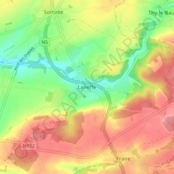
Name: Laneffe topographic map, elevation, terrain.
Location: Laneffe, Walcourt, Philippeville, Namen, Wallonië, 5651, België (50.25784 4.47502 50.29784 4.51502)
Average elevation: 227 m
Minimum elevation: 171 m
Maximum elevation: 278 m
Other topographic maps
Click on a map to view its topography, its elevation and its terrain.
Walcourt
België > Namen > Philippeville > Walcourt
Walcourt, Philippeville, Namen, Wallonië, 5650, België
Average elevation: 214 m