
Kepa Bush Reserve topographic map
Interactive map
Click on the map to display elevation.
About this map
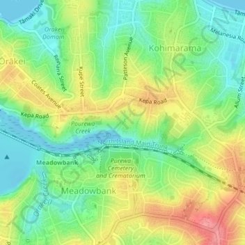
Name: Kepa Bush Reserve topographic map, elevation, terrain.
Average elevation: 34 m
Minimum elevation: -1 m
Maximum elevation: 81 m
Other topographic maps
Click on a map to view its topography, its elevation and its terrain.
Glover Park
New Zealand > Auckland > Orakei
Glover Park, Saint Heliers, Ōrākei, Auckland, New Zealand
Average elevation: 13 m
Orakei Domain
New Zealand > Auckland > Orakei
Orakei Domain, Orakei, Ōrākei, Auckland, New Zealand
Average elevation: 17 m
Mount Hobson
New Zealand > Auckland > Orakei
Mount Hobson, Ōrākei, Auckland, 1040, New Zealand
Average elevation: 66 m