
Obley topographic map
Interactive map
Click on the map to display elevation.
About this map
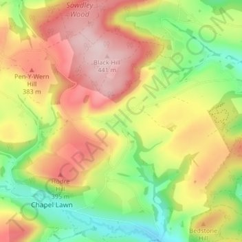
Name: Obley topographic map, elevation, terrain.
Location: Obley, Clunbury, Shropshire, England, SY7 0BZ, United Kingdom (52.37456 -3.00772 52.41456 -2.96772)
Average elevation: 310 m
Minimum elevation: 174 m
Maximum elevation: 447 m