
Unionville topographic map
Interactive map
Click on the map to display elevation.
About this map
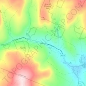
Name: Unionville topographic map, elevation, terrain.
Average elevation: 450 m
Minimum elevation: 270 m
Maximum elevation: 673 m
Other topographic maps
Click on a map to view its topography, its elevation and its terrain.
Claryville
United States > New York > Sullivan County > Town of Neversink
Claryville, Town of Neversink, Sullivan County, New York, 12725, United States
Average elevation: 628 m
Grahamsville
United States > New York > Sullivan County > Town of Neversink
Grahamsville, Town of Neversink, Sullivan County, New York, United States
Average elevation: 397 m
Willowemoc
United States > New York > Sullivan County > Town of Neversink
Willowemoc, Town of Neversink, Sullivan County, New York, United States
Average elevation: 630 m