
Amapala topographic map
Interactive map
Click on the map to display elevation.
About this map
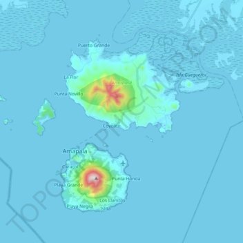
Name: Amapala topographic map, elevation, terrain.
Location: Amapala, Valle, Honduras (13.24881 -87.72291 13.37953 -87.54261)
Average elevation: 24 m
Minimum elevation: 0 m
Maximum elevation: 768 m
Other topographic maps
Click on a map to view its topography, its elevation and its terrain.