
Santa Fe topographic map
Interactive map
Click on the map to display elevation.
About this map
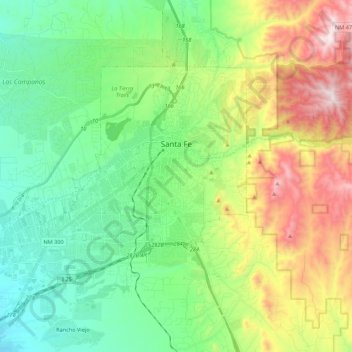
Name: Santa Fe topographic map, elevation, terrain.
Location: Santa Fe, Santa Fe County, Nieuw-Mexico, VS (35.58804 -106.11374 35.75398 -105.89432)
Average elevation: 2,222 m
Minimum elevation: 1,914 m
Maximum elevation: 2,863 m