
La Potte topographic map
Interactive map
Click on the map to display elevation.
About this map
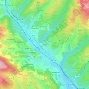
Name: La Potte topographic map, elevation, terrain.
Average elevation: 376 m
Minimum elevation: 258 m
Maximum elevation: 605 m
Other topographic maps
Click on a map to view its topography, its elevation and its terrain.
Saint-Victor et les Voutte
France > Auvergne-Rhône-Alpes > Rhône > Ternand
Saint-Victor et les Voutte, Ternand, Villefranche-sur-Saône, Rhône, Auvergne-Rhône-Alpes, France métropolitaine, 69620, France
Average elevation: 390 m
Ronzière
France > Auvergne-Rhône-Alpes > Rhône > Ternand
Ronzière, Ternand, Villefranche-sur-Saône, Rhône, Circonscription départementale du Rhône, Auvergne-Rhône-Alpes, France métropolitaine, 69620, France
Average elevation: 380 m