
Thank you for supporting this site ❤️
Make a donation
Make a donation
Chivhu topographic map
Click on the map to display elevation.
Thank you for supporting this site ❤️
Make a donation
Make a donation
About this map
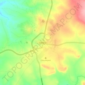
Name: Chivhu topographic map, elevation, terrain.
Location: Chivhu, Chikomba, Mashonaland East Province, Zimbabwe (-19.05870 30.85695 -18.97870 30.93695)
Average elevation: 1,447 m
Minimum elevation: 1,390 m
Maximum elevation: 1,515 m
Thank you for supporting this site ❤️
Make a donation
Make a donation