
Alger Centre topographic map
Interactive map
Click on the map to display elevation.
About this map
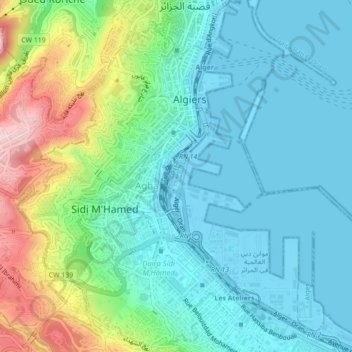
Name: Alger Centre topographic map, elevation, terrain.
Location: Alger Centre, Daïra Sidi M'Hamed, Alger, Algérie (36.75221 3.03885 36.78319 3.08255)
Average elevation: 63 m
Minimum elevation: -3 m
Maximum elevation: 250 m