
Achterbos topographic map
Interactive map
Click on the map to display elevation.
About this map
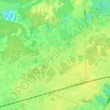
Name: Achterbos topographic map, elevation, terrain.
Location: Achterbos, Mol, Turnhout, Antwerpen, Vlaanderen, 2400, België (51.18080 5.07798 51.22080 5.11798)
Average elevation: 26 m
Minimum elevation: 15 m
Maximum elevation: 31 m